Omni Admin
Contributors

Funding


Omni-SimStad Admin Portal Guide
The Omni-SimStad Control Panel provides engineers and pedagogues with a secure environment to modify exhibition states, update localized strings, and provision cartographic data layers.
The control panel implements deep ordering rules (django-adminsortable2) and inline localization components (django-modeltranslation) across English (en) and Swedish (sv).
1. Exhibition Structural Hierarchies
Data layout structures are managed downstream through a clear structural hierarchy:
City Exhibit -> Featured Themes (Collections) -> Dynamic Scenarios -> Target Render Layers
Managing Cities (Exhibitions)
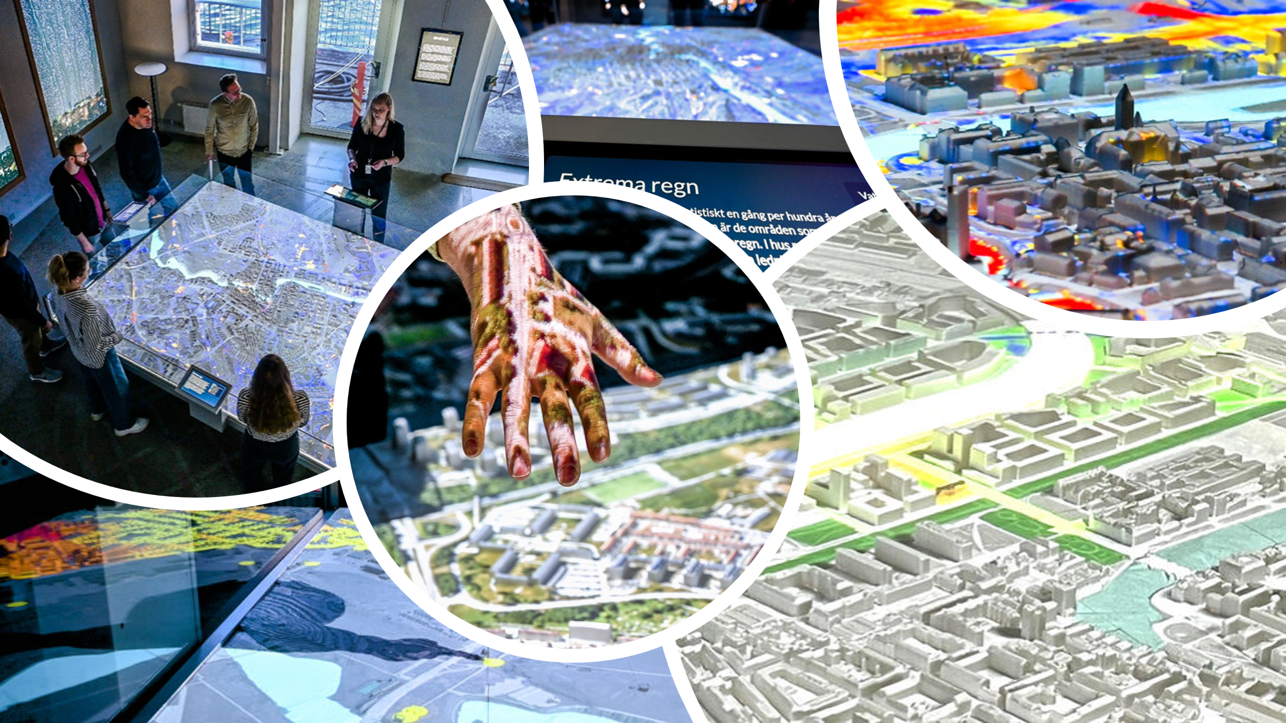
Each City Exhibit entry correlates to a physical interactive table installation inside the exhibition gallery.
- Coordinates & Mapping: Spatial bounds are explicitly formatted using the Swedish National Grid system (SWEREF 99 TM). Altering
min_x,max_x,min_y, andmax_ychanges the boundary metrics used by frontend coordinates. - Orientation Controls: The
Orientationproperty adapts interface viewpoints to match the physical orientation of user panels positioned around the town physical model layout (North,East,South,West). - Featured Collections: You can prioritize featured themes on the home screen directly within the city layout view using the grab handles to change display sorting.
Managing Collections (Themes)
Collections package individual scenarios into clean public thematic clusters (e.g., Sustainable Transportation Elements, Historical Grid Evolutions).
- Filter by city using the right sidebar to avoid layout configuration overlap.
- Upload a high-resolution cover image; an inline visual preview confirms whether it renders safely without UI sizing issues.
2. Deep Dive: Scenarios & Composited Layers
Scenarios determine how computational maps display spatial data assets on user consoles.
Scenario Display Mechanics
When creating or editing a Scenario, you must establish its primary canvas presentation structure using the Layer Display Mode:
- Stacked Mode: Renders all defined sub-layers concurrently, blending visual elements together sequentially based on their
orderindex values. - Sequential Mode: Bundles components onto an interactive timeline slider widget. This mode leverages localized
Sequence Labels(e.g., "1950", "2000", "2026") to switch active visual layers on the map framework.
Layer Architectural Types & Configuration Matrix
Layers are nested inside Scenarios. Clicking the layer type selector updates active inputs via internal layout scripts (layer.js). You must configure specific matching parameters based on your selected layer mode:
| Layer Type | Required Target Attributes | Behavioral Description |
|---|---|---|
| Image | Raster (Media Type: image) | Renders standard static geographic datasets, structural zoning shapes, or underlying street maps. |
| Flow | Raster + Flow Texture + Scale/Speed | Renders moving vector fields. Calculated using a base raster color vector overlay wrapped with a noise texture asset. |
| Movie | Raster (Media Type: video) | Streams looping video structures over the map layout at configurable playback speed rates (movie_speed). |
| Color | Solid Color Hex | Generates a uniform vector tint overlay utilizing a pop-up field palette picker. |
| NDI | NDI Stream Name + NDI Machine | Accesses live over-the-network video feeds directly, bypassing local server file directories. |
┌────────────────────────────────────────────────────────┐
│                   SCENARIO RENDERING                   │
├────────────────────────────────────────────────────────┤
│ Layer 3: NDI Layer (Live Simulator Feed)              │
├────────────────────────────────────────────────────────┤
│ Layer 2: Flow Layer (Dynamic Vector Particle Movement) │
├────────────────────────────────────────────────────────┤
│ Layer 1: Image Layer (Base SWEREF 99 Map Canvas)       │
└────────────────────────────────────────────────────────┘
Advanced Adjustments & Spatial Cropping
Open the Advanced and Cropping tabs to perform micro-adjustments on individual layers:
- Opacity ($0.0 \rightarrow 1.0$): Sets layer transparency limits.
- Emission ($0.0 \rightarrow N$): Adjusts self-illumination strengths, allowing glowing elements (like night windows or data nodes) to stand out.
- Locked Order: In Sequential Mode, checking this option locks a layer (e.g., a baseline topography map) to keep it visible across all timeline slider steps.
- Slice Cropping: Uses horizontal and vertical coordinates ($u, v$ bounds from $0.0$ to $1.0$) to trim rectangular map sections.
- Circle Cropping: Pinpoints a center point coordinate (
crop_center_u,crop_center_v) and applies a radial clip (crop_radius) to focus the display on a specific circular area.
3. Automation and Asset Bulk Pipelines
The asset pipeline includes built-in automation routines to save management time for engineers and pedagogues.
Rasters and Automatic Optimization Tools
The Raster section manages static assets and dynamic video files. To speed up workflow, look for the Bulk Upload Rasters button in the top right corner of the list page.
┌──────────────────────────────────────────────────────────────────┐
│  BULK RASTER UPLOADER                                            │
├──────────────────────────────────────────────────────────────────┤
│  Target City: [ Stockholm Exhibit    v ]                         │
│  Assign Tags: [ [x] Infrastructure  [x] 2026 Planning ]          │
│  Drop Files:  [ file1.png, file2.mp4, file3.png  ]               │
├──────────────────────────────────────────────────────────────────┤
│  [ >> Execute Parallel Asset Processing Pipeline << ]            │
└──────────────────────────────────────────────────────────────────┘
When you click save, the server triggers an automatic backend processing loop:
- Filename Standardization: Cleans asset files, forcing lowercase extensions matching your database target key identifiers.
- Key-Collision Guard: Auto-generates clean, incremental unique system keys if filenames conflict.
- Automated Layout Generation: Processes underlying imagery or video frames to automatically populate
minimapandthumbnailfields, ensuring assets render quickly on frontend operator tablets.
4. Map Legend Management Systems
Map legend elements can be configured manually via structural panels or imported instantly using structured configuration keys.
JSON Import Configuration Engine
For maps containing numerous data categories, use the Import Legend from JSON pipeline instead of building entries row by row.
[
  {
    "text": "Residential High-Density Zones",
    "color": "#FF5733",
    "type": "rectangle"
  },
  {
    "text": "Protected Ecological Wetland",
    "color": "#2ECC71",
    "type": "circle"
  }
]
When you paste this structured array into the utility window, the system processes your layout choices sequentially:
- Parses nested keys and maps the text fields to matching language rows (
text_en/text_sv). - Extracts color codes directly into hex fields.
- Searches database symbols for a matching identifier (e.g., checking for type names like
"rectangle"or"circle"). If no exact match is found, it safely falls back to your first active default asset icon.
5. UI Localization Mapping
The Localized Strings workspace acts as a central glossary for user interface elements that aren't tied to any single database object (such as instructional buttons, system reset prompts, and slider headers).
- Each entry contains an immutable system tracking code (
key) alongside bilingual text areas (text_enandtext_sv). - Modifying these translation blocks updates text displays instantly across all external frontend screen connections without requiring app restarts or software reinstalls.