Omni
Contributors


Funding


Omni-SimStad API Documentation
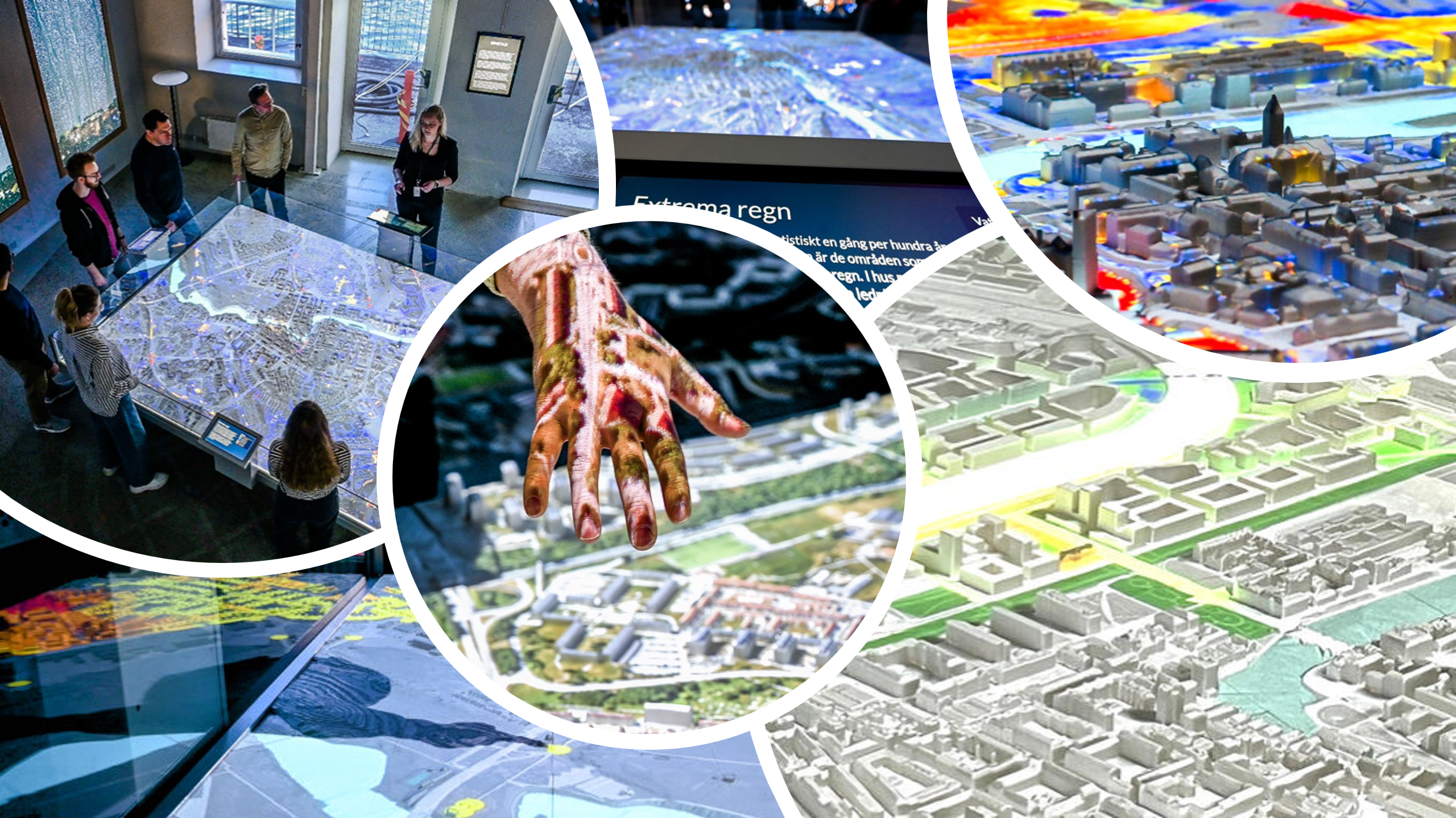
The Omni-SimStad Django application serves as the core database manager and state engine for the public SimStad exhibit. It acts as a specialized subsystem under the umbrella of the larger Omni Backend Ecosystem, which coordinates multi-display, interactive installations.
While administrative stakeholders (engineers and pedagogues) use the Django Admin panel to alter spatial layers, legends, and metadata, the frontend exhibit nodes and interactive screens query this API in real time to fetch data payloads. Additionally, specific server-rendered routes are consumed by external hardware—such as PixiLab Blocks monitors—to dynamically output active legends.
1. Architectural Overview & Context
   ┌────────────────────────────────────────────────────────┐
   │                  OMNI BACKEND SYSTEM                   │
   │  (Unified ecosystem for multi-display infrastructure)  │
   └───────────────────────────┬────────────────────────────┘
                               │
                               ▼
 ┌──────────────────────────────────────────────────────────────┐
 │                    OMNI-SIMSTAD SERVER                       │
 ├──────────────────────────────┬───────────────────────────────┤
 │     Django Admin Panel       │         REST API              │
 │  (Engineers & Pedagogues)    │  (Exhibition Interfaces)      │
 └──────────────────────────────┴──────────────┬────────────────┘
                                               │
                       ┌───────────────────────┴───────────────────────┐
                       ▼                                               ▼
         ┌───────────────────────────┐                   ┌───────────────────────────┐
         │ Interactive Exhibit Nodes │                   │   PixiLab Blocks Screens  │
         │   (Cities / Scenarios)    │                   │   (Dynamic HTML Legends)  │
         └───────────────────────────┘                   └───────────────────────────┘
The server manages a hierarchical data matrix optimizing geographic, temporal, and spatial visualization sequences. The core engine models map data via discrete raster types (Images, Videos, Vector Flows, and Live Network Device Interface (NDI) streams) structured across predefined exhibition domains.
2. API Endpoint Registry
All endpoints expect a base target matching your environment routing and return standardized JSON arrays or object payloads unless specified otherwise.
Exhibition Hierarchy & Configuration
| Method | Endpoint | Description | Payload Type |
|---|---|---|---|
GET | /get_cities/ | Fetches all active exhibition city instances. | Array |
GET | /get_city/<str:city_key>/ | Retrieves complete structural configuration for a targeted city. | Object |
GET | /get_collections/ | Fetches collection groupings that tie scenarios into coherent themes. | Array |
GET | /get_collection/<str:collection_key>/ | Retrieves data and scenario lists mapped to a single theme. | Object |
Spatial & Layer Content Engines
| Method | Endpoint | Description | Payload Type |
|---|---|---|---|
GET | /get_scenarios/ | Fetches global scenarios list across all installations. | Array |
GET | /get_scenario/<str:scenario_key>/ | Pulls a scenario configuration along with its layered rendering matrix. | Object |
GET | /get_rasters/ | Lists comprehensive image, video, and stream metadata assets. | Array |
GET | /get_raster/<str:raster_key>/ | Pulls explicit system-paths, thumbnails, and key properties for a raster. | Object |
Legends, Tags, and Localizations
| Method | Endpoint | Description | Payload Type |
|---|---|---|---|
GET | /get_legends/ | Fetches tabular legend objects. | Array |
GET | /get_legend/<str:legend_key>/ | Pulls entries, color hex arrays, and symbols for a legend. | Object |
GET | /get_symbols/ | Fetches list of all validated UI symbology graphics. | Array |
GET | /get_symbol/<str:symbol_key>/ | Pulls a single symbology asset file link. | Object |
GET | /get_tags/ | Returns structural classification tags used to organize rasters. | Array |
GET | /get_tag/<str:tag_key>/ | Returns a specific tag resource object. | Object |
GET | /get_localization/ | Compiles a full map of interface-agnostic key-value strings for UI rendering. | Object |
Dynamic Screen Routing
| Method | Endpoint | Description | Response Type |
|---|---|---|---|
GET | /legend/<str:scenario_key>/ | Server-rendered view outputting the current map legend layout. | HTML |
GET | /legend/<str:scenario_key1>/<str:scenario_key2>/ | Server-rendered comparison view displaying a side-by-side or combined legend layout. | HTML |
3. Core Data Object Mappings
When interacting with the API, returned objects follow specific structural conventions based on the relational schema of the backend:
City
Defines a geographic coordinate canvas based on the Swedish coordinate system system (SWEREF 99 TM), tracking UI orientation parameters and fallback loops.
key(String): Unique alphanumeric system handle.name(String): Public exhibit title.service(Integer/ID): Reference ID linking the client node to its real-time WebSocket communication broker.min_x/max_x/min_y/max_y(Float): Bounding box limits for geographic tracking.orientation(String): Camera layout orientation relative to the physical city mockup table (north,east,south,west).raster_width/raster_height(Integer): Resolution specifications of the display canvas in pixels.default_blocks_video(String): Path to video loops rendered on standby when the client connection sits idle.
Scenario & Layers
Scenarios determine exactly how informational visual maps parse onto screen components. The scenario specifies a layout behavior: stacked (where layers blend together using specific attributes) or sequential (which provisions a timeline/slider matrix based on sequence_labels).
A Scenario object exposes a nested sequence of Layer configurations sorted by order. Every layer object includes specialized parameters based on its type:
{
  "key": "traffic-evolution-2026",
  "name": "Traffic Evolution Analysis",
  "layer_display_mode": "sequential",
  "sequence_title": "Select Target Horizon Year",
  "layers": [
    {
      "type": "image",
      "order": 1,
      "opacity": 0.85,
      "emission": 0.2,
      "crop_type": "slice",
      "crop_data": {
        "type": "slice",
        "slice": { "min_u": 0.0, "max_u": 0.5, "min_v": 0.0, "max_v": 1.0 }
      },
      "raster": "base-map-layer"
    },
    {
      "type": "flow",
      "order": 2,
      "opacity": 1.0,
      "flow_scale": 1.5,
      "flow_speed": 2.0,
      "raster": "vector-velocity-map",
      "flow_texture": "particle-noise-texture"
    },
    {
      "type": "ndi",
      "order": 3,
      "ndi_stream": "LIVE_SIM_FEED_01",
      "ndi_machine": "RENDER_NODE_LEFT"
    }
  ]
}
⚠️ Layer Validation Constants
Image Layers: Require a
rasterasset whosemedia_typeis validated strictly asimage.Flow Layers: Require a primary base
raster(image) and an accompanyingflow_texture(image) to calculate vector paths.Movie Layers: Require a
rasterasset whosemedia_typeis validated strictly asvideo.Color Layers: Generate flat vector solid shapes based on hex codes parsed through the
colorattribute.NDI Layers: Leverage live network streams and require
ndi_streamfields filled to bypass storage loops entirely.
Raster Assets
The Raster engine handles standard mapping layers and automatically generates minimaps and thumbnails upon modification:
media_type: Disambiguates whether the core asset follows theimageorvideoschema validation loop.image/video: Native paths targeting static resource allocations.minimap/thumbnail: Automatically generated scaling outputs used for rendering local UI navigation assets on client panels.
4. Hardware Integrations (PixiLab Blocks Monitors)
To accommodate structural screens that frame map models, Omni-SimStad uses explicit server-side templates via specialized endpoints:
Single Legend Canvas
GET /legend/<scenario_key>/
Parses the legend or legend_image property bound to a requested Scenario. If utilizing custom elements, it reads related nested LegendEntry values, delivering matching symbols and hexadecimal color indicators straight to digital displays.
Dual Comparison Canvas
GET /legend/<scenario_key1>/<scenario_key2>/
Processes dual scenario configurations to construct side-by-side matrices or composite comparative layouts on displays configured around multi-option interactives.
Ready to move on to the second part? Share your admin.py file whenever you're set, and we can draft the documentation for the administrative tools used by your engineers and pedagogues.